
The origins of our Global Position System are actually pretty interesting. And it tracks very closely with the fictional history of the Lattice in The Lattice Trilogy (which is available as a box set if you haven’t read it).
Let’s start with the history of The Lattice in the books. In the future, the US develops the Lattice as a secret defense project to spy on the rest of the world. It works! They can see all of history and they can see thoughts of anyone they want to. They have total knowledge. That is, until Japan figures out how to hack into the signal with their own Lattice reader. The US can’t cut Japan out of Lattice without turning the entire Lattice off. So they decide to open it to the public and give US companies a chance to catch up and make their own Lattice readers.
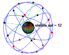
This is not actually so far from what happened with GPS! The Global Positioning System was originally only supposed to be a military project to help guide missiles and coordinate troops.
Things changed in the 80s when a Korean Air passenger jet strayed into USSR airspace and was shot down. Reagan announced shortly afterward that GPS would be made available to aviation and civilian-use. In short, anyone whether in the US or elsewhere would be able to buy a device to get a signal from these military satellites.
But the US Defense Department had some qualms about that. What if precise location targeting could be used against them? They didn’t want to give everyone full access to a military-quality signal, so they degraded the system they offered to the public. Publicly available GPS devices in the 80s and 90s were intentionally wrong (by a few meters on land and by as much as a hundred meters of elevation) unless you had a special US military device.
The exception to this was during 1991 Gulf War. The military-grade units were in short supply and individual soldiers bought civilian-level GPS units off the shelves and brought them into the war zone! The US decided that was too great a risk for them to have incorrect positioning while at war and they and stopped degrading the civilian signal for the rest of the conflict. For a brief time, everyone had perfect GPS.
After the war, the public GPS system was again degraded until 2000, when Bill Clinton eventually signed a law that allowed everyone—from airliners to the military to all of us holding our smart phones—to get the same signal. A great example of the democratization of technology.
Oddly, 2000 also marks the time I was introduced to GPS, only to have it yanked away from me. For six weeks in college I was a student sailor on the 125’ schooner SSV Westward. The ship had 23 students and 10 crew. We were there to sail the ship—work the rigging, run the science lab, and eventually lead a watch.
I had a six hour shift in the day, 4 hours at night (7-11, 11-3, or 3-7 every night), class every day, a research paper to write, and we cleaned the ship every Sunday. It was the hardest I’ve ever worked in my life.
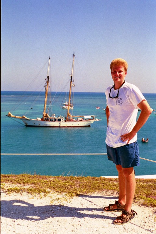
Me with the SSV Westward in the background, a ship that I spent six weeks sailing on in the Caribbean. Picture taken on an old Civil War era naval fort in the Dry Tortugas.
But we weren’t allowed to use GPS. The GPS machine on board the Westward had a little piece of paper over the display that we weren’t allowed to touch. Instead, I learned how to use a sextant—literally navigating by stars at night and by taking sun lines during the day. We learned dead reckoning (speed x direction to estimate location), and used radar and LIDAR for positioning.
We sailed old school for six weeks, leaving from Key West, going through the Bahamas, visiting Cuba for a few days (we had a special educational visa to do so), then south to Honduras where we stayed another few days, and then up through the Yucatán Straits to the Dry Tortugas and back to Key West again.
As you can imagine, that was a formative six weeks for me!
And for anyone who had read The Iron Harvest, it’s easy to see why I was so excited to put Byron Shaw on a ship in the Mediterranean without The Lattice to navigate.
Ever since 2000, GPS has been good enough that you usually just have to glance at it to see where you are. Being at sea without it, though, meant that you had to work for it, and use a series of different tools to get the answer. That’s what I wanted to put Shaw and the reader through in Book II of The Lattice Trilogy.
So that’s where the history of The Lattice came from. An updated retelling of how we got GPS. And the chance to write about what it’s like to sail without it.